

AlpineQuest Explorer Lite
Category : Travel & LocalVersion: 2.3.8d
Size:8.0 MBOS : Android 2.1+
Developer:Psyberia
 Download
 Transform your smartphone into a robust off-road GPS navigator using offline topographic maps with AlpineQuest! Enjoy a seamless experience with **no advertisements, no data sharing or monetization, no analytics, and no third-party libraries**—just pure, uninterrupted exploration.
AlpineQuest is your ultimate companion for a wide array of outdoor activities and sports, including hiking, running, trailing, hunting, sailing, geocaching, and off-road navigation. With the ability to download and store a vast selection of **online topographic maps locally**, you'll have access to detailed mapping even when you're out of cell service. Additionally, AlpineQuest supports numerous **on-board file-based raster map formats** to enhance your navigation toolkit.
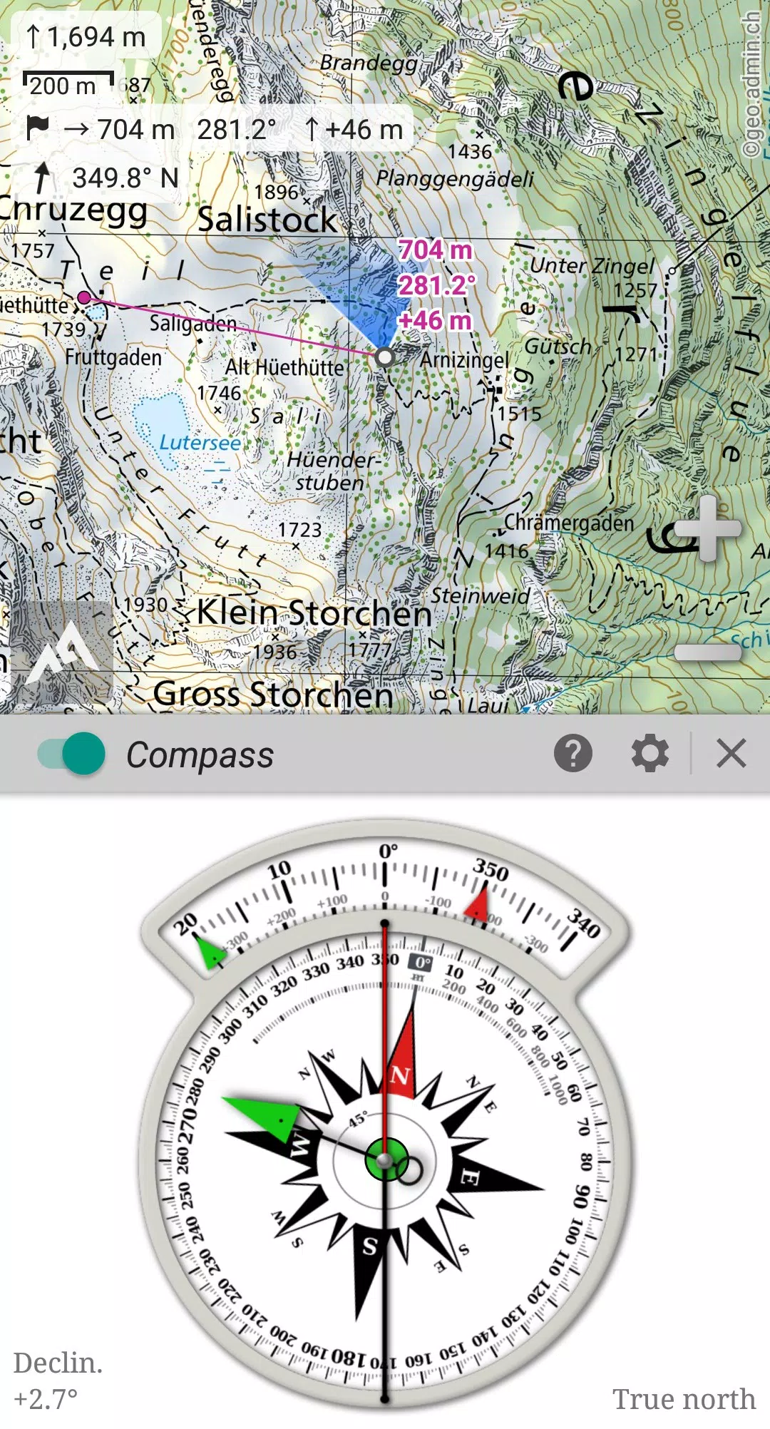
Leverage the power of your device's GPS and magnetic sensor, complete with a compass display, to ensure you're never lost. AlpineQuest provides **real-time localization on the map**, which can be oriented to align with your field of view, making navigation intuitive and precise.
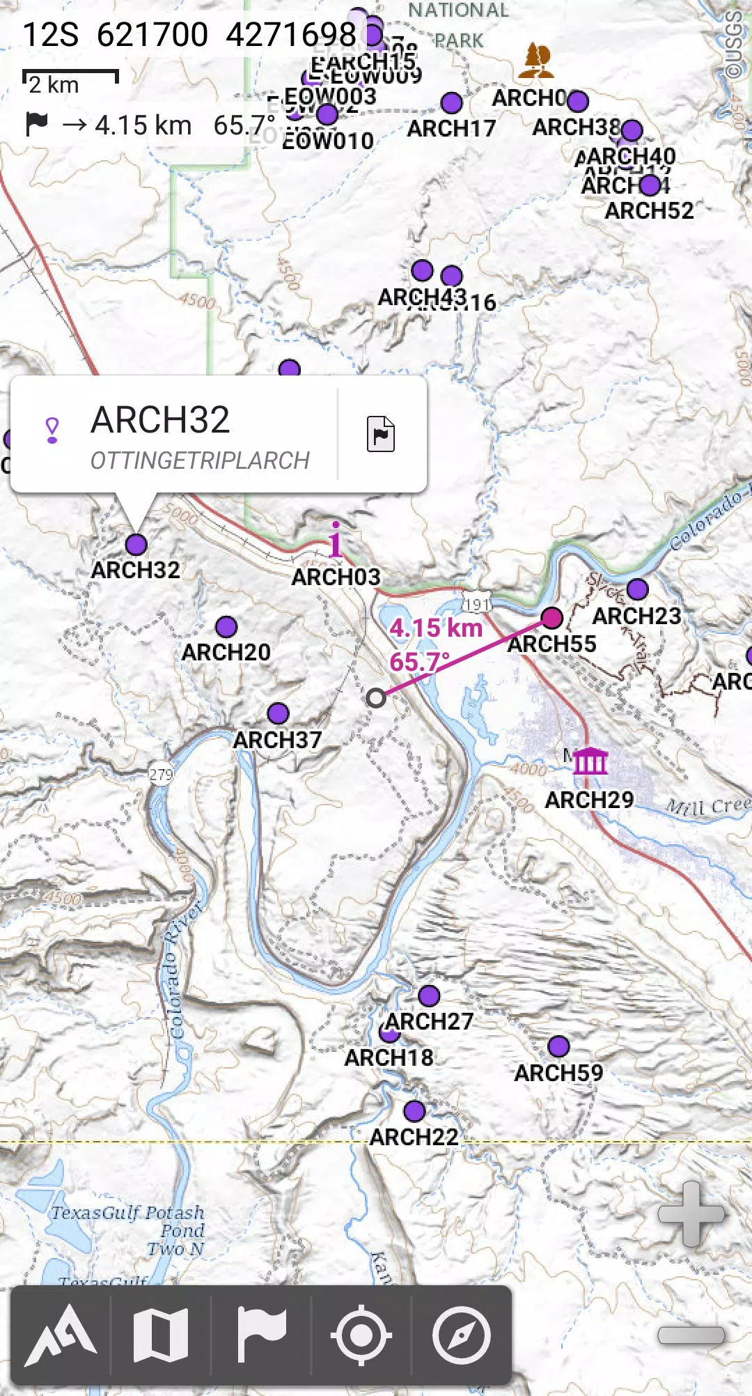
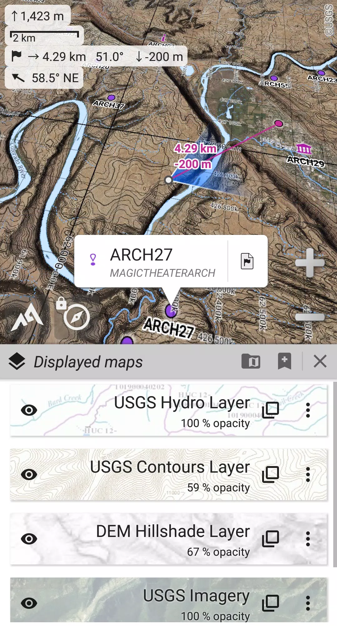
Save an unlimited number of **placemarks** and share them with friends. **Track** your journeys, access **advanced statistics**, and enjoy **interactive graphics** that detail your adventures comprehensively. Whether you're deep in the wilderness or exploring abroad, AlpineQuest remains fully operational without cell coverage, supporting your every exploration desire.
**Don't wait—download the Lite version for free today and experience the difference!**
For any suggestions or issues, please visit our dedicated forum at https://www.alpinequest.net/forum (no registration required, all questions answered) instead of leaving comments.
Key Features (Full Version):
★★ Maps ★★
- Built-in **online maps** with **automatic local storage** (including road, topo, and satellite maps) and **online layers** (road names, hillshade, contours).
- Access a wide range of additional online maps and layers with one click from our community maps list, covering major worldwide and local topographic maps.
- Complete **area storage** for offline use of online maps.
- Support for **on-board offline maps** (raster) including **KMZ Overlays, OziExplorer OZFx2, OZFx3 (partly), and calibrated images, GeoTiff, GeoPackage GeoPkg, MbTile, SqliteDB, and TMS** zipped tiles. Visit our website to download MOBAC, the free map creator.
- **QuickChart** Memory Map support (.qct maps only, .qc3 maps not compatible).
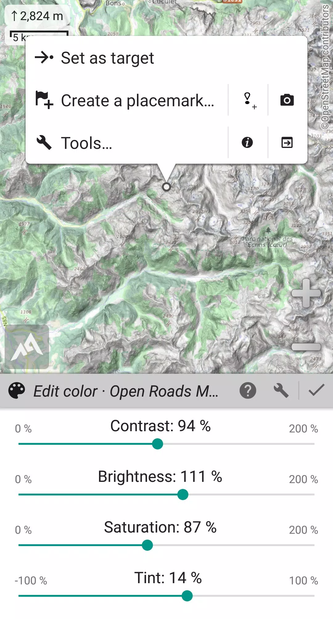
- Built-in **image calibration tool** to use any scan or picture as a map.
- **Digital elevation model** on-board storage (1-arcsec SRTM DEM) and support for **HGT** elevation files (1-arcsec and 3-arcsec resolutions) for displaying **terrain**, **hillshade**, and **steep slopes**.
- **Polar maps** (Arctic and Antarctic) support.
- Display multiple **maps in layers** with individual controls for opacity, contrast, color, tint, and blending.
★★ Placemarks ★★
- Create, display, save, and restore an **unlimited number of items** such as waypoints, routes, areas, and tracks.
- Import and export **GPX** files, **Google Earth KML/KMZ** files, and **CSV/TSV** files.
- Import **ShapeFile SHP/PRJ/DBF, OziExplorer WPT/PLT, GeoJSON, IGC tracks, Geocaching LOC** waypoints, and export **AutoCAD DXF** files.
- Save and share online locations with the community using Community Placemarks.
- View **details**, **advanced statistics**, and **interactive graphics** for various items.
- Use the Time Controller to replay time-tagged tracks.
★★ GNSS Position / Orientation ★★
- On-map geolocation using your device's GNSS receivers (GPS/Glonass/Galileo/…) or Network.
- Map orientation, **compass**, and target finder for precise navigation.
- Built-in **GNSS/Barometric track recorder** capable of long tracking, running in a separate and light process, with battery level and network strength recording.
- Proximity alerts and leave path alerts to keep you on track.
- Barometer support for compatible devices.
★★ Additional Features ★★
- Support for metric, imperial, nautical, and hybrid distance units.
- Various latitude/longitude and grid coordinate formats (WGS, UTM, MGRS, USNG, OSGB, SK42, Lambert, QTH, …) with on-map grids display.
- Import hundreds of coordinate formats from https://www.spatialreference.org.
- And much more...
What's New in Version 2.3.8d
Last updated on Aug 14, 2024
- Added a new setting to customize the display style and side of the menu bar.
- Improved compatibility with recent Android versions.
- Enhanced backup and restore tool functionality.
- New default URL for sharing coordinates as text.
- Option to set the application's "Media" folder as default for placemarks, icons, pictures, and file-based maps.
- Added Croatian and Persian translations.
- Various improvements and bug fixes.


-
Best Action Games to Play Now
A total of 10 Hazmob: FPS Gun Shooting Games Mazinger Z salva a Venezuela KOF 2003 ACA NEOGEO ASTRA: Knights of Veda Battle Cats Survivors Stickman Legacy: Giant War Hunting Simulator 4x4 MOLD: Space Zombie Infection Hopeless 3: Dark Hollow Earth Mod Gunship Combat Helicopter Game
-

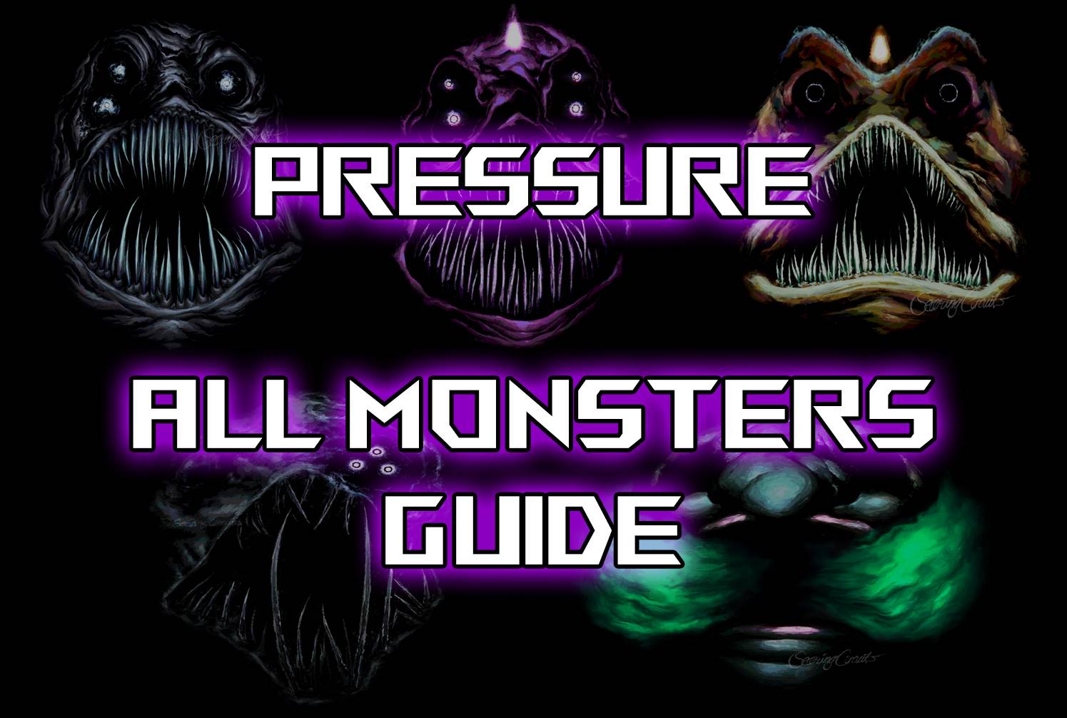
Surviving All Monsters in Roblox Pressure: A Guide
Nintendo Unveils Switch 1 Direct Before Switch 2 Event
- AMD Unveils Next-Gen Laptop Chips Using Last-Gen Architecture 16 hours ago
- Epic Seven Reveals Prequel Story, Enhances QoL 16 hours ago
- Top Star Wars Tabletop Games of 2025 16 hours ago
- Supercell's Squad Busters Launches in China 17 hours ago
- Kingambit Joins Pokémon Go in Crown Clash Event Next Month 17 hours ago
- Lysanthir Beastbane Fusion: RAID Shadow Legends Guide 18 hours ago
- Alienware's Area-51 Now Supports RTX 5090 Graphics Card 18 hours ago
- Reviver hits storefronts later this month, letting you remake history with one small change 18 hours ago
- Stumble Guys Unveils Cowboys & Ninjas and Looney Tunes Maps 18 hours ago
-

Personalization / 1.0.0 / by DigitalPowerDEV / 11.10M
Download -

Video Players & Editors / v1.6.4 / by Vodesy Studio / 62.41M
Download -

Video Players & Editors / v1.02 / by TateSAV / 13.80M
Download -

Productivity / 1.5 / 51.00M
Download -

Lifestyle / 1.5 / by BetterPlace Safety Solutions Pvt Ltd / 9.60M
Download


-
 All Passwords and Padlock Combinations in Lost Records: Bloom and Rage
-
 30 best mods for The Sims 2
-
 Tokyo Game Show 2024 Dates and Schedule: Everything We Know So Far
-
 Best Android PS1 Emulator - Which PlayStation Emulator Should I Use?
-
 Ultimate Basketball Zero Zones Tier List – Best Zone & Style Combos
-
 Hogwarts Legacy 2 Confirmed: HBO Series Connection